Activity 2 Map for Materials

Map for Activity 2 of Sustainable Fishing 4-H STEM Toolkit which shows for August-October temperature and depths for various bodies of water. From left to right: Pond #1, 50-70℉, Depth = 60m; River, 52-75℉, Depth = 0-15m; River #2, 52-75℉, Depth = 0-15m; Pond #2, 55-70℉, Depth = 20m; Lake, 40-70℉, Depth = 150m; Ocean various depths and temperatures – 55, 60 and 70℉; and 0-20m, 100m and 200m. Key for image, ℉ = degrees fahrenheit and m = meters

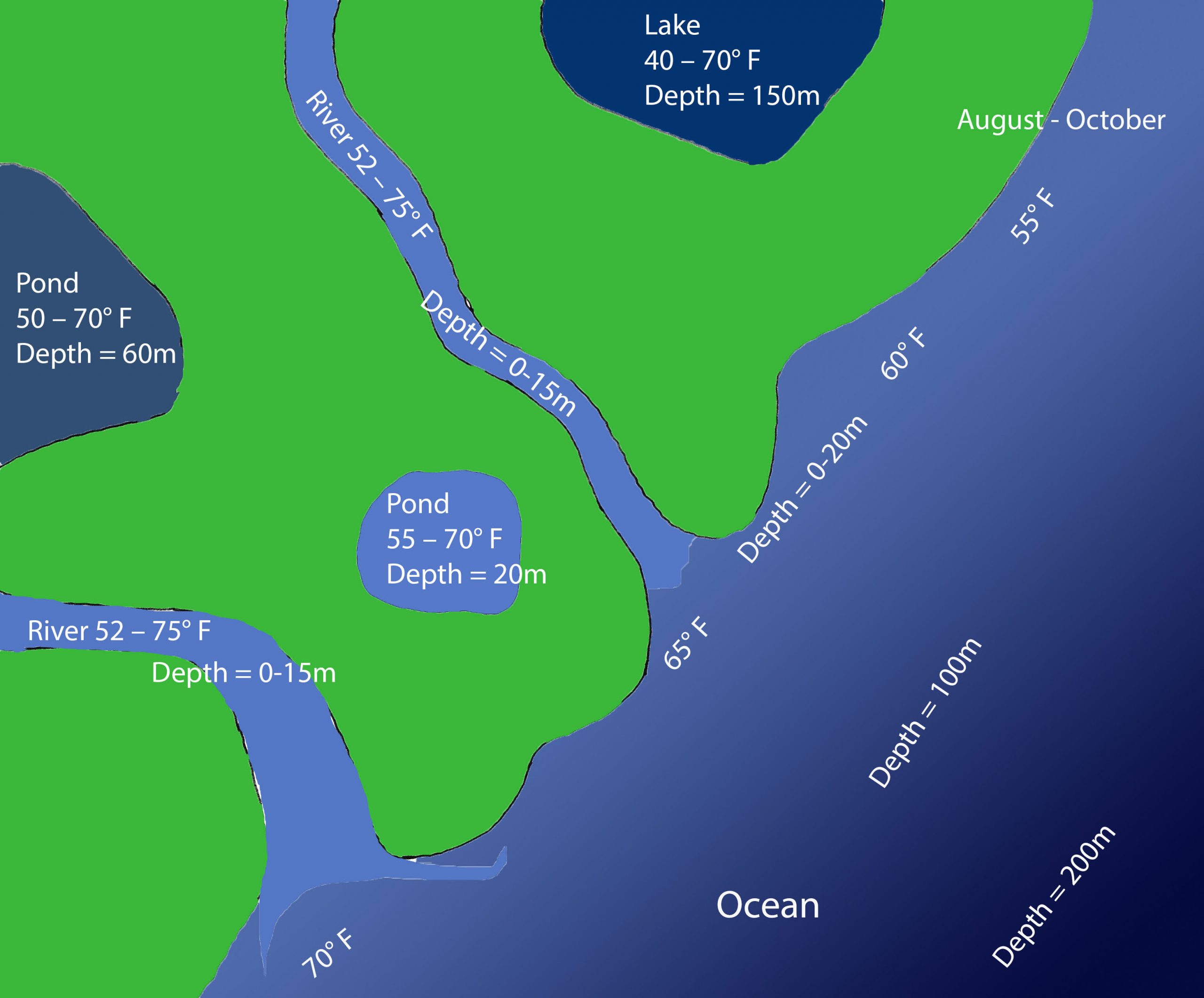
Drawing provided courtesy of the Maine Department of Marine Resources Recreational Fisheries program and the Maine Outdoor Heritage Fund.