Northeast Drought Early Warning Update
Drought Emerging, Expanding, and Strengthening
June 26, 2020
This Drought Early Warning Update is issued in partnership between the National Oceanic and Atmospheric Administration (NOAA), U.S. Geological Survey, and the U.S. Department of Agriculture (USDA) to communicate concern for drought expansion and intensification within the Northeast U.S. based on recent conditions and the forecasts and outlooks. NIDIS and its partners will issue future Drought Early Warning Updates as conditions evolve.
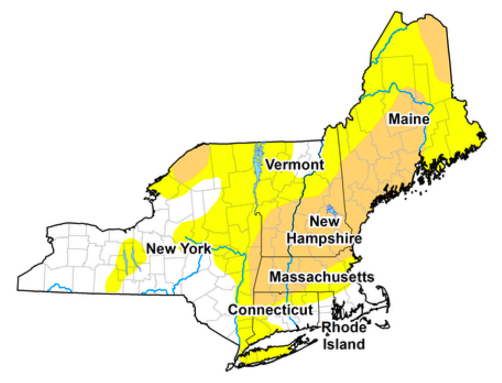
This covers the following states in the Northeast U.S.: Maine, New Hampshire, Vermont, Massachusetts, Connecticut, Rhode Island, and New York.
For more details, see the Northeast Drought Early Warning System Dashboard.
Key Points
- Moderate Drought (D1) has emerged throughout much of New England and the St. Lawrence Valley in New York, while Abnormally Dry (D0) conditions exist in eastern, northern, and central New York.
- Impacts include moisture stress on crops, low stream flows, soil moisture deficits, municipal water advisories/restrictions, fire danger, and burn bans.
- Weather forecasts indicate warm and dry conditions will persist. This may lead to intensifying drought conditions. Drought Task Forces and work groups are meeting to review their plans and monitor conditions/forecasts that may parallel the drought onset in the Northeast during the summer of 2016.