Winter and Spring 2017, Arctic Ice
Weather and Climate Review: Winter 2017 (December-February)
By Sean D. Birkel, Maine State Climatologist, June 5, 2017
Winter 2017 was warm and wet. The statewide average winter temperature was 20.1 °F, ranking fifteenth warmest against the season mean for the 20th century. This follows record warmth in winter 2016.
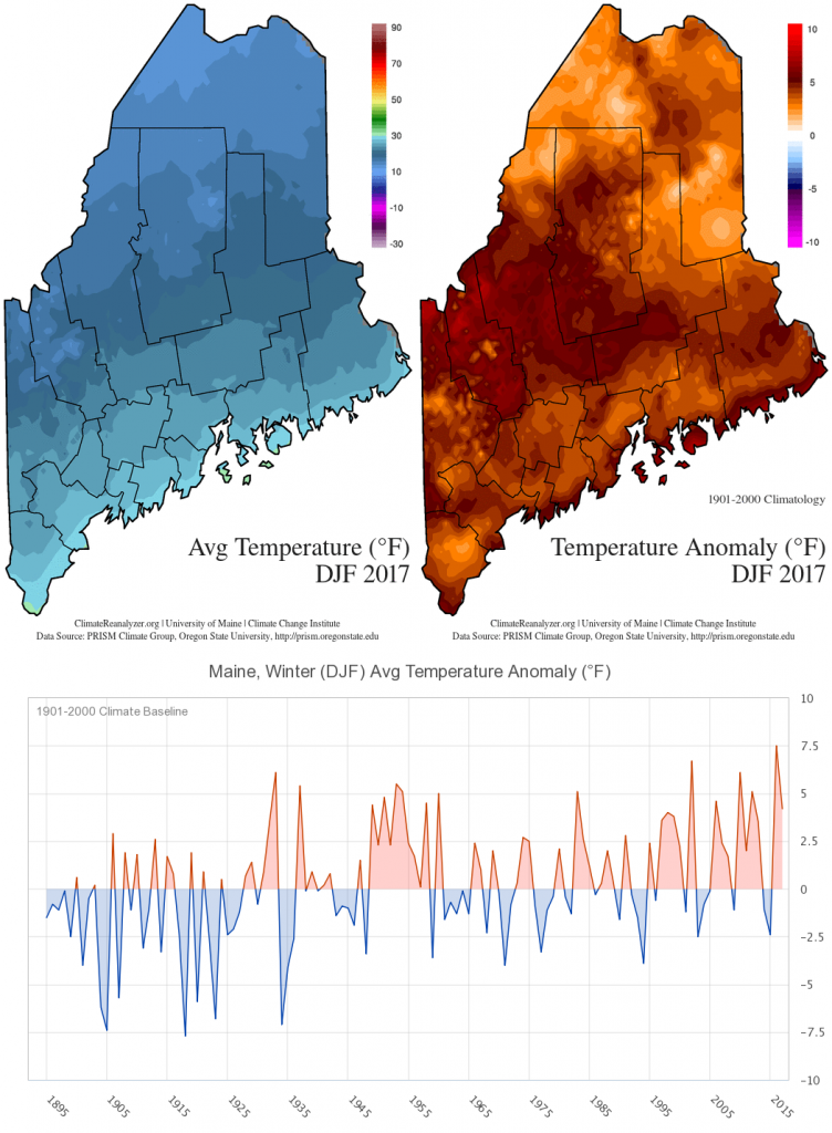
Winter 2017 precipitation was 2.3 inches more than normal, totaling 11.7 inches water equivalent, contributing to an end of the 2016 drought.
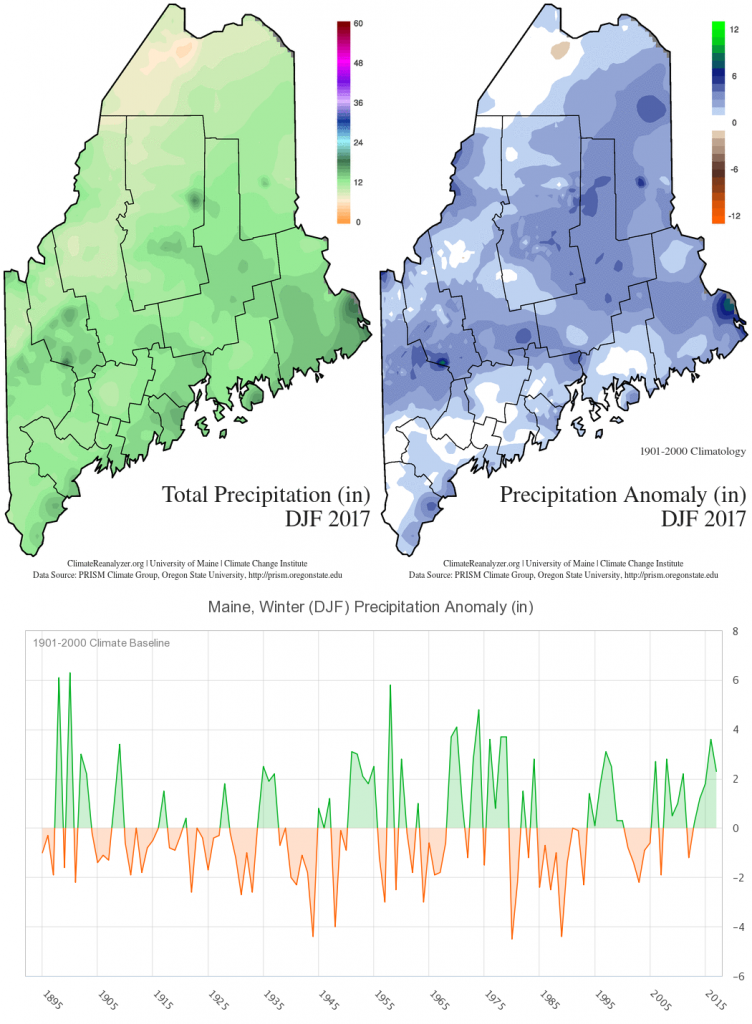
One particularly notable event from winter 2017 was a major nor’easter February 12-13 that delivered over 30” snowfall to some areas of central Maine and Downeast.
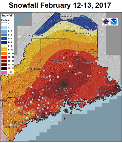
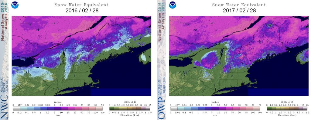
As with other recent warm winters (most notably 2010, 2012, 2016), winter 2017 for the southern half of the state saw several rainfall events that degraded the snowpack. However, nearly all of the state retained snow cover by the end of February, thus providing an important starting condition for spring that contributes to groundwater and lake levels.
Spring (March-May)
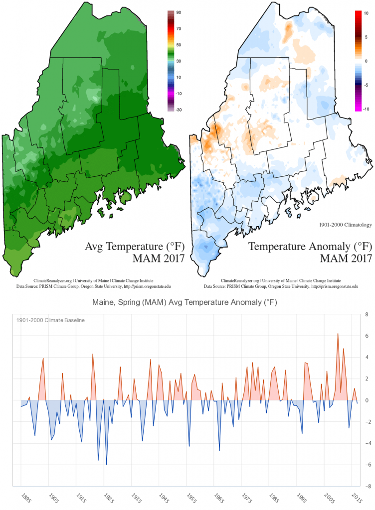
Spring 2017 was generally cool and wet. The statewide average spring temperature was 38 °F, ranking slightly below than the season mean for the 20th century. This ranking is mostly due to March, which was the third coldest since 1984 behind 2015 and 2014. April was warmer than normal; May was near normal.
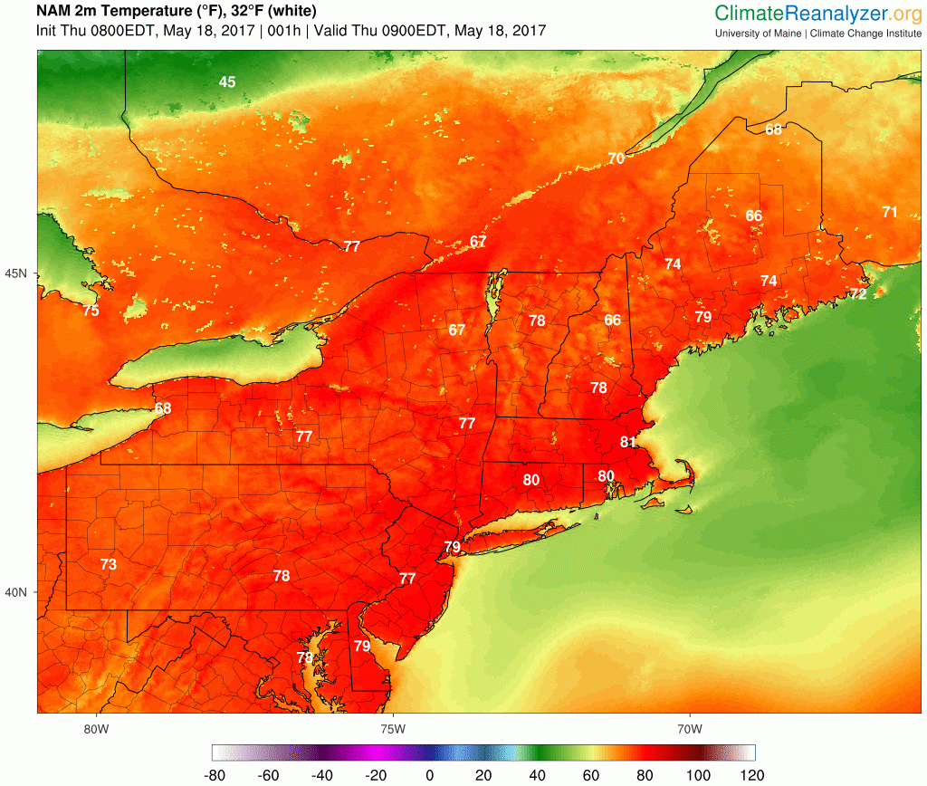
A heat wave developed Thursday, May 18, when daytime high temperature across the state soared into the 80s (northern and western) and low 90s (southern and central), breaking some records. The event was short-lived, however, due to a cold front that advanced across the state the next day (highs in the 70s Friday, May 19, 50s and 60s over the weekend).
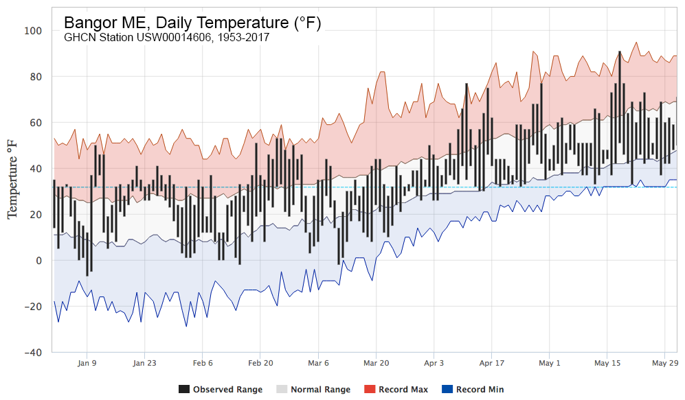
May temperatures reaching above 90 °F is rare, but not in itself exceptional for the southern half of Maine from a historical perspective. However, so far in 2017 record maximum daily temperature in Bangor was matched (to within 1 degree) or exceeded on 9 occasions between January 1 and May 31, whereas record minimum daily temperature was matched or exceeded only three times. Thus, 2017 continues the trend of a warming climate.
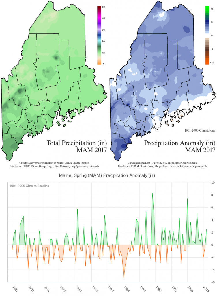
Spring 2017 precipitation was 2.5 inches more than normal, totaling of 12.3 inches water equivalent.
Increased snowfall and a longer snow season compared to last year contributed to easing of the 2016 drought.
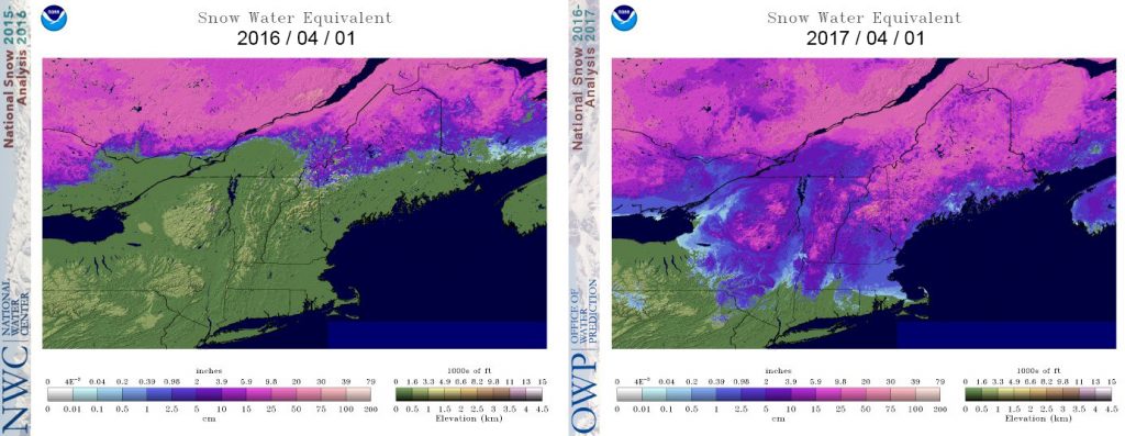
The National Drought Mitigation Center and National Weather Service reported in the third week in April in the article, Maine is awash, bringing yearlong drought to an end (April 27, 2017, Portland Press Herald), that groundwater levels were back to normal across most of the state, and therefore drought was effectively over.
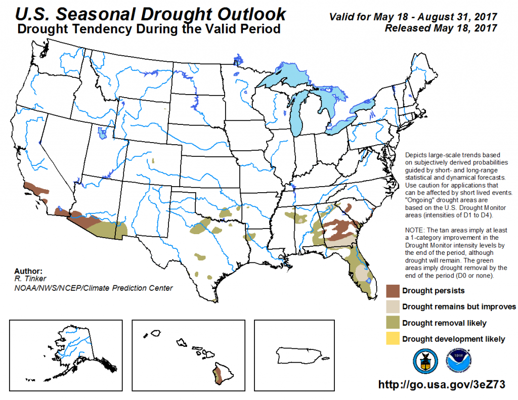
The latest U.S. Seasonal Drought Outlook (National Weather Service Climate Prediction Center) published on May 18 by NOAA projects drought conditions for only limited sections of the southeastern and southwestern U.S. this summer.
Keep an Eye on the Arctic
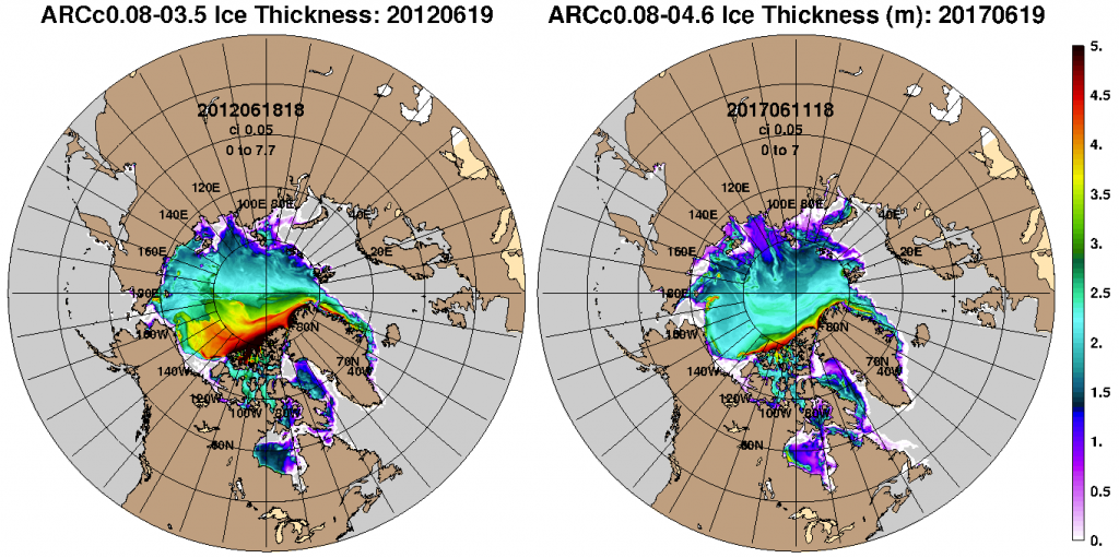
Climate in Maine and across the Northern Hemisphere is heavily impacted by the declining extent and thickness of Arctic sea ice. Sea-ice loss caused by warming temperatures presents feedback, where each summer less ice enables more solar radiation to be absorbed by the Arctic Ocean, which warms the waters and promotes further ice loss; the fall season is then extended as the thinner, less extensive ice affords more heat release from the ocean to the atmosphere. A lengthened fall furthermore means a delayed winter, which ultimately results in a reduced accumulation of freezing degrees under which ice thickens. Ultimately, reduction in the extent and thickness of Arctic sea ice alters difference in temperature between the equator and pole, which then changes the circulation of the atmosphere.
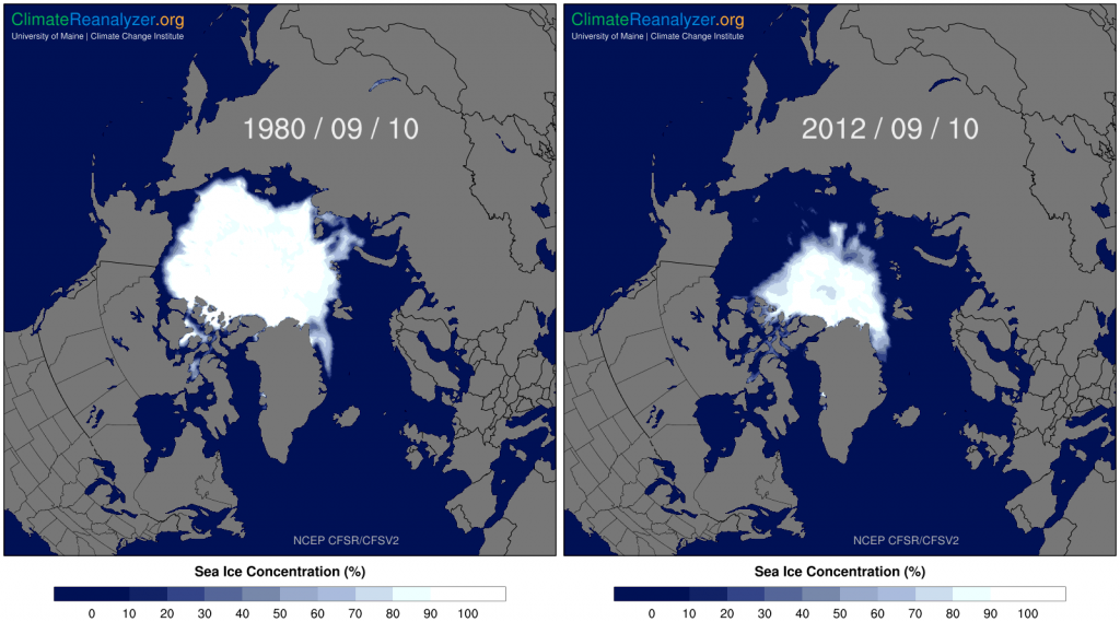
There remains disagreement among scientists as to the precise way in which circulation is being altered, but a prominent view suggests a linkage between Arctic sea-ice loss and an increase in the incidence of extreme climate events – heat and cold waves, record rain and snowfall – that has been observed across the Northern Hemisphere in the past decade.
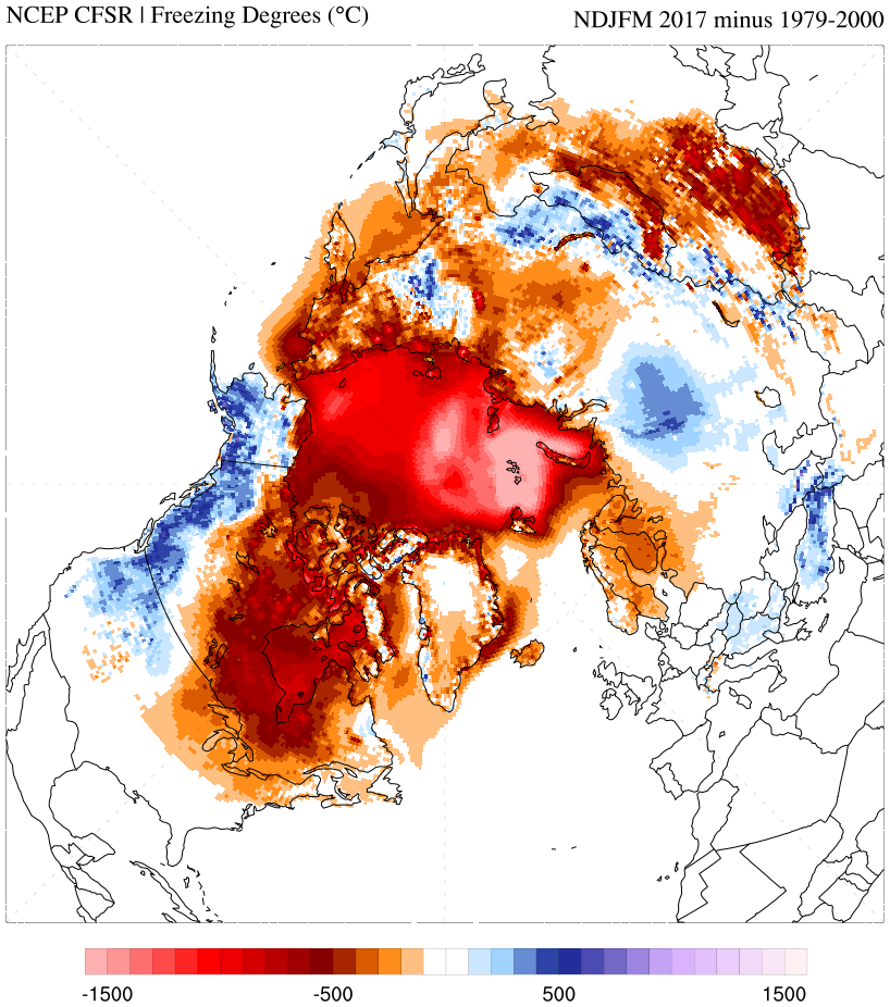
It is noteworthy that the 2016-2017 winter was the warmest on record across the Arctic Basin with the least number of accumulated freezing degrees.
Record low minimum sea-ice extents were attained in 2007 and 2012 when the ice area stood at less than half the typical minimum extents observed prior to the 1980s. The 2017 melt season has started off with much thinner ice than any year yet in the era of daily satellite observations beginning in late 1978, which has scientists speculating in the article Arctic Sea Ice Primed for Phenomenal Melt Season, Bob Henson, June 9, 2017 (WU, Weather Underground website) that come September there will be yet a new record minimum extent.
What will this mean for Maine? Time will tell.
