 With regular features and information about climate in Maine and beyond, Maine Climate News is a joint effort of three of the University of Maine’s well-known units: the Climate Change Institute, Maine Sea Grant, and Cooperative Extension. All of these entities have an emphasis on climate change and its implications for Maine.
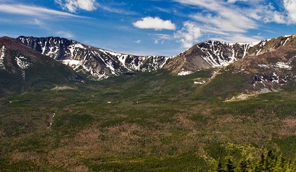
The site is intended to provide useful information and perspectives about Maine’s climate. Because climate represents long-term patterns (as opposed to the short-term weather records that are provided daily by the National Weather Service), we will review what is known about the past (paleoclimate), the present (weather data compiled from roughly the past century, the time of modern instrumental measurements), and the future (estimated from computer simulations of various kinds).
2024 Winter Webinar Series: Using Weather-Based Tools to Adapt to a Changing Climate
Professional Development for Agricultural Service Providers and Producers
Join University of Maine Cooperative Extension and Sustainable Agriculture Research & Education (SARE) in this three-part series focused on practical weather resources and tools that can help producers adapt to climate change.
Explore Maine Climate News


Maine Summer 2022 Climate Summary
By Dr. Sean Birkel, Maine State Climatologist
- The Maine statewide average summer (June–August or JJA) 2022 climate ranks 10th warmest (tied with 1938, 2005, 2010, 2012) and 35th wettest since 1895.
- Drought emerged for a third summer in a row, impacting the southern half of the state, in particular the midcoast region, most significantly.
- Global JJA average temperature ties 2015 and 2017 as 5th warmest since 1880, despite persistent cool conditions across the eastern Pacific in association with La Nina.
- The end-of-summer Arctic sea ice extent was attained around September 18th and ranks 12th lowest for the satellite observation era.
Maine Spring 2022 Climate Summary
By Dr. Sean Birkel, Maine State Climatologist
- The 2022 spring (March–May or MAM) was 11th warmest and 48th wettest since 1895.
- As of the end of May, abnormal dryness or moderate drought affected only about 12% of Maine, and near-normal conditions were found elsewhere. (Update 7/15/2022: Precipitation deficits have developed over the past month such that abnormal dryness or moderate drought is now seen across about 75% of the state. The most recent drought information can be found on the Northeast Drought Early Warning System Dashboard.)
- Global 2022 MAM average temperature tied 2018 for 6th warmest since 1880, despite persistent cool conditions across the eastern Pacific in association with La Niña.
- Arctic sea ice extent at the end of May ranked 14th lowest for this time of year in the record of continuous satellite observations.
Maine Calendar Year 2021 Climate Summary
By Dr. Sean Birkel, Maine State Climatologist
- The 2021 calendar year was 2nd warmest and 39th driest in Maine based on observations beginning 1895.
- While most of the state has seen near-normal annual accumulated precipitation this year, moderate to severe drought persists across an area of northern Oxford, Franklin, and Somerset counties along the Quebec border.
- The global 2021 calendar year average temperature was 6th warmest based on observations beginning 1880, despite persistent cool conditions across the eastern Pacific in association with La Niña.
Maine Fall 2021 Climate Summary
By Dr. Sean Birkel, Maine State Climatologist
- The 2021 fall (September–November or SON) was 3rd warmest and 31st wettest since 1895.
- Abundant rainfall in September and near-normal conditions in October contributed the removal of drought and dryness across nearly all of Maine, with the exception of a contiguous area over western and northwestern along the Quebec border.
- Global SON average temperature was 4th warmest since 1880, despite persistent cool conditions across the eastern Pacific in association with La Nina.
Maine Summer 2021 Climate Summary
By Dr. Sean Birkel, Maine State Climatologist
- The 2021 summer (June–July) was 4th warmest and 49th driest since 1895.
- A drought signal from 2020 carried into this year, but impacts during the summer were less severe due to sufficient beneficial rains.
- The 2021 August minimum monthly temperature was warmest on record owing to record high atmospheric moisture content.
- Global JJA average temperature was 4th warmest since 1880.
- The minimum extent of Arctic sea ice, which occurs annually in September, ranked 11th lowest for the era of satellite observations.
- Cool La Niña conditions have developed across the equatorial Pacific and are expected to influence Maine’s weather this winter.
Maine Summer 2020 Climate Summary
By Dr. Sean Birkel, Maine State Climatologist
On the three-month average, summer 2020 was considerably warmer than the 20th-century baseline and saw the development of the most severe short-term drought since the early 2000s. The drought has caused a significant impact on water resources and agriculture across much of the state. Notable aspects of this drought are the record number of days without rainfall for some observation sites, and record low water level and flow on at least the Piscataquis and St. John rivers. Drought persists despite beneficial rainfall in late September and early October. Refer to the NOAA Climate Prediction Center for the latest temperature and precipitation outlook guidance.
Maine Spring 2020 Climate Summary
By Dr. Sean Birkel, Maine State Climatologist
The Maine statewide climatological spring (March-May [MAM]) 2020 average temperature was 39.6 °F, or 72nd percentile for the 125-year record period beginning 1895. This temperature is 2.4 °F warmer than that observed for the same period in 2019, and 1.4 °F above the 1901-2000 historical mean. The observed MAM total precipitation was 9.4 inches, or 44th percentile for the record period. This precipitation amount is 2.6 inches less than that observed in 2019, and 0.7 inches above the 1901-2000 historical mean, or near normal. In total for MAM 2020, there were 40 high and 33 low daily temperature, 32 high precipitation, and 42 high snowfall records either broken or tied statewide (data from NOAA Daily Weather Records).
Maine Winter 2020 Climate Summary
By Dr. Sean Birkel, Maine State Climatologist
The Maine statewide winter (December-February [DJF]) 2020 average temperature was 21.2 °F, ranking 6th warmest for the 125-year record period beginning 1895 (Fig. 1). This temperature is 4.3 °F warmer than that observed for the same period in 2019, and 5.6 °F above the 1901–2000 historical mean. The observed DJF total precipitation was 9.7 inches, ranking 53rd wettest since 1895 (Fig. 2). This precipitation amount is 2.2 inches less than that observed in 2019, and 0.1 inches above the 1901-2000 historical mean, or near normal. In total for DJF 2020, there were 29 high and 11 low daily temperature, 35 high precipitation, and 22 high snowfall records either broken or tied statewide (data from NOAA Daily Weather Records).
Research Highlights: Uncovering the Past Through Maine’s Historic Phenology Data
Phenological observations of annual first flowers, first leaves, and first migratory bird arrivals are a very valuable component of climate change research and historical phenology records provide baselines for learning about the effects of climate change on biota and biological processes. Dr. Caitlin McDonough’s research delves into long-term historical phenology records, such as the Quackenbush journals of northern Maine, to identify the fingerprint of anthropogenic climate change in ecological communities.
Maine Climate and Agriculture
The purpose of the Maine Climate and Agriculture Network, initiated by faculty at the University of Maine, is to increase communication and coordination among those working on issues related to climate and agriculture. The Maine Climate and Ag Network website provides an initial portal to some of the climate-related activities at the University of Maine, and serves as an invitation to those with an interest in this topic to participate.
Maine’s Climate Future – 2020 Update
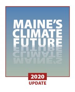 Maine’s Climate Future – 2020 demonstrates the progression of accelerating change in the climate in Maine and its effects, reflecting dramatic evidence for accelerating climate change around the globe with the often dire consequences of those changes.
Nearly every climate-related parameter measured in Maine is accelerating, according to the report. The rate of air and sea warming is increasing. Precipitation is increasing in intensity and volume, and sea level is not only rising, but rising faster than in the previous century.
Key new findings include faster rates of warming along the coast compared to interior and northern Maine, and changes in Maine winters. Average minimum temperatures in Maine are warming 60% faster than average maximums.
The report points to the growing evidence of impacts of these changes on Maine’s farms, fields, forests, marine resources, and aspects of our culture and economy. The report also points to resources and activities that represent opportunities to address the climate challenge, and actions that Mainers are taking to deal with climate-related changes
“This report hopes to connect Maine people with the information they need for decision-making,” says Ivan Fernandez, UMaine professor of soil science and forest resources, and the report’s lead author.
“This 2020 update, while alarming, affirms that Maine people have the will and capacity to thrive in uncertain times,” says Catherine Schmitt, Schoodic Institute science communication specialist and a co-author of the report.
Maine Climate News Blog
-
Quarterly Climate Impacts and Outlook, Northeast Region, June 2020
-
Northeast Drought Early Warning Update
-
Northeast Snow Season Recap
-
USDA Northeast Climate Hub Reports Another Warm Winter
-
Preparing for a Changing Climate: The State of Adaptation Planning in Maine’s Coastal Communities
-
UMaine scientists involved in ranking “mountain water towers”
-
Special Intergovernmental Panel Climate Change (IPCC) Report
-
2019 Gulf of Maine Region Climate Report
![]()
![]()
![]()